
Expert perspectives on Saudi Arabia customs, ocean & air freight, and global supply chain strategies.

Latest market trends, port developments, and international container freight analysis.

Technical case studies and operational insights for complex industrial project transport.
High-precision GNSS RTK rovers, autonomous road marking robots, heavy-payload survey drones, and tracked rig chassis for over-dimensional cargo path validation.

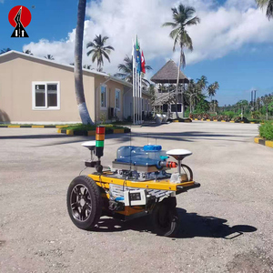
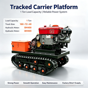
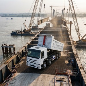
Executing the land transport of super-heavy, over-dimensional cargo (ODC) such as refinery fractionating columns, power plant transformers, desalination evaporators, and wind turbine components demands flawless engineering rigor. A single unmapped bridge structural limit, undetected overhead clearance restriction, or inadequate turning radius can result in catastrophic delays, infrastructure damage, or multimillion-dollar equipment loss. As a world-class heavy transport route survey factory and specialized engineering supplier, SOHO Shipping & Logistics delivers rigorous feasibility studies, 3D LiDAR terrain scans, dynamic swept-path analyses, and structural axle load calculations that mitigate risk across every mile of transport corridors.
To satisfy the strict regulatory frameworks enforced by transport authorities such as the Saudi Ministry of Transport, SABIC Logistics Compliance, and Saudi Aramco Road Safety Standards, an end-to-end heavy haulage survey protocol must execute four primary engineering steps:
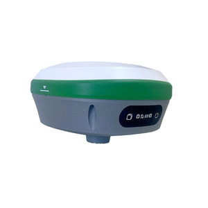
The integration of autonomous robotics—such as RTK GNSS Pre-Marking Robots and heavy-load survey UGVs—represents a major technology shift in highway layout and route preparation. By utilizing multi-constellation RTK receivers capable of tracking 1408 channels across GPS, GLONASS, BeiDou, and Galileo networks, surveying teams can autonomously mark obstacle bypass routes, temporary staging pads, and heavy transport centerlines with centimeter-level repeatability.
Based in Jubail, Kingdom of Saudi Arabia, SOHO Shipping & Logistics operates at the intersection of heavy transport engineering, international freight forwarding, and turnkey route clearing.
Trusted supplier and logistics engineering partner for SABIC, Saudi Aramco, NEOM, SEC, SAIPEM, Samsung Engineering, and Hyundai Heavy Industries.
From port-of-entry custom brokerage to utility line lifting, bypass civil works, traffic management permits, and escort convoy coordination.
Direct synergy between survey data and operational execution using SPMTs, heavy dumpers with Weichai engines, and specialized modular trailers.
ISO certified operations, FIATA membership, and WCA network accreditation guaranteeing international standards for all survey deliverables.
Deploying 6-axis heavy payload drones and autonomous UGV wheeled mobile platforms for all-weather, high-altitude route scanning.
Round-the-clock telematics monitoring and real-time RTK GPS tracking across remote desert transport corridors and industrial zones.
| Survey Parameter | Traditional Manual Survey | Autonomous RTK-LiDAR Survey (Our Standard) | Operational Impact / ROI |
|---|---|---|---|
| Height Clearance Measurement | Manual measuring poles (high safety hazard) | Mobile 3D LiDAR Scanning (0.01s point density) | 100% collision risk elimination |
| Positioning Accuracy | Standard GPS (±2m to ±5m margin) | 1408-Channel Multi-GNSS RTK (±1cm precision) | Zero route deviation error |
| Swept-Path Feasibility | Estimated 2D geometry drawings | Dynamic 3D Swept-Path CAD Simulation | Accurate street furniture removal planning |
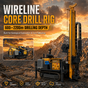
| Geological Terrain Assessment | Visual surface inspection | Tracked Rig Core Drilling & GPR Sub-surface Scans | Prevents trailer ground sinkage |
| Survey Execution Speed | 15 – 25 km / day | 150 – 300 km / day (Mobile Scanning UGV) | 75% reduction in feasibility turnaround |
How emerging autonomous technology, digital twin modelling, and ESG compliance are transforming global heavy haulage procurement strategies.
Procurement heads are prioritizing suppliers who offer real-time Digital Twin models of industrial transport corridors. By combining drone LiDAR data with virtual trailer dynamics, logistics teams can simulate complex superload maneuvers before physical equipment leaves the factory floor.
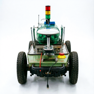
The procurement of self-propelled RTK pre-marking robots and all-weather UGVs is replacing manual site surveying. Autonomous fleets lower surveyor safety exposure in high-risk zones (such as active highways or mining sites) while accelerating route layout speed.
Future survey hardware contracts demand unified hardware suites—integrating 1408-channel GNSS receivers, inertial measurement units (IMU), thermal cameras, and subsurface ground radar on a single mobile chassis for simultaneous surface and structural analysis.
A Heavy Transport Route Survey is an engineering investigation of a proposed transport corridor to verify that over-dimensional or heavy-lift cargo (superloads) can travel safely without impacting public infrastructure or damaging the cargo. It analyzes vertical clearances, horizontal turning radii, bridge axle weight capacity, road gradients, overhead power lines, and soil compaction. Civil authorities require certified survey reports before issuing heavy-haul permits.
1408-channel RTK (Real-Time Kinematic) GNSS rovers track all operational satellite constellations (GPS, GLONASS, BeiDou, Galileo, QZSS) simultaneously. This high channel count ensures stable differential correction signals even in deep canyons, dense industrial plants, or remote desert terrain, delivering horizontal positioning accuracy down to 8mm + 1ppm and vertical accuracy of 15mm + 1ppm.
Our comprehensive engineering report includes 3D LiDAR point cloud models, height clearance bottleneck identification, bridge bending moment & shear calculations, CAD swept-path turning simulations, ground bearing pressure assessments for unpaved bypasses, a list of required utility modifications (such as raising power lines), traffic escort plans, and official permit submission documentation.
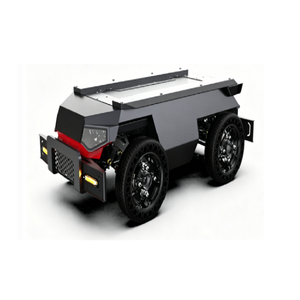
Yes. Heavy load tracked crawler platforms (e.g., HR-600F and 500kg load capacity steel-frame vehicles) are specifically engineered for high-altitude geological survey works, desert sand dunes, and muddy off-road mining paths. Their low ground pressure distribution prevents equipment sinking and allows accurate surveying where standard wheeled vehicles cannot operate.
For major EPC oil & gas or mining infrastructure projects, route surveys should be commissioned 3 to 6 months prior to shipment. This lead time allows for engineering reviews, civil road modifications (such as widening turning radii or constructing temporary bypasses), utility company notifications, and government permit approvals.
You can click the "Get Catalog" button anywhere on this page to instantly launch our direct inquiry channel. Our engineering team will supply technical datasheets, CAD models, case studies, and customized quotation proposals tailored to your specific project requirements.
Streamline your superload logistics with certified LiDAR 3D scanning, RTK positioning, and turnkey route clearance solutions verified by Middle East industry leaders.